
Water-in-Place:
Social Distanced
Self-Guided
Local Creek Visits
Whenever’s Safe
to Leave Your House: 2020-2021
Self-guided creek/arroyo visits to visit on your own during shelter-in-place. Featuring special lesser-known spots, unlikely to be closed or crowded.
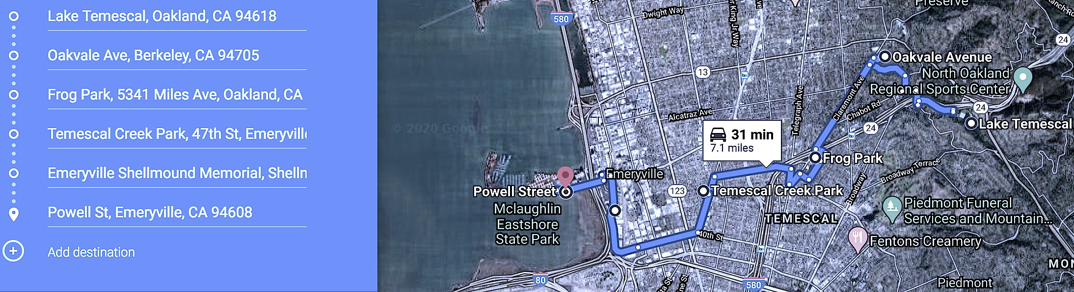
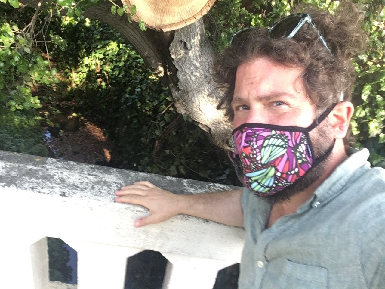
Temescal Creek ~ Oakland/Berkeley
Temescal Creek cradled a central village of the Huchiun indigenous community for tens of thousands of years. The largest shellmound complex on the shores of San Francisco Bay grew steadily for generations adjascent to the creek outflow, until it was leveled in 1924. The Aztec word temescalli was adopted to refer to sweat houses that stood along the creek banks.


This driving/walking tour offers 6 stops for witnessing very different sections of creek. Driving portion including all stops is around 30 minutes, walking portion adds another hour or two, depending on your curiosity.
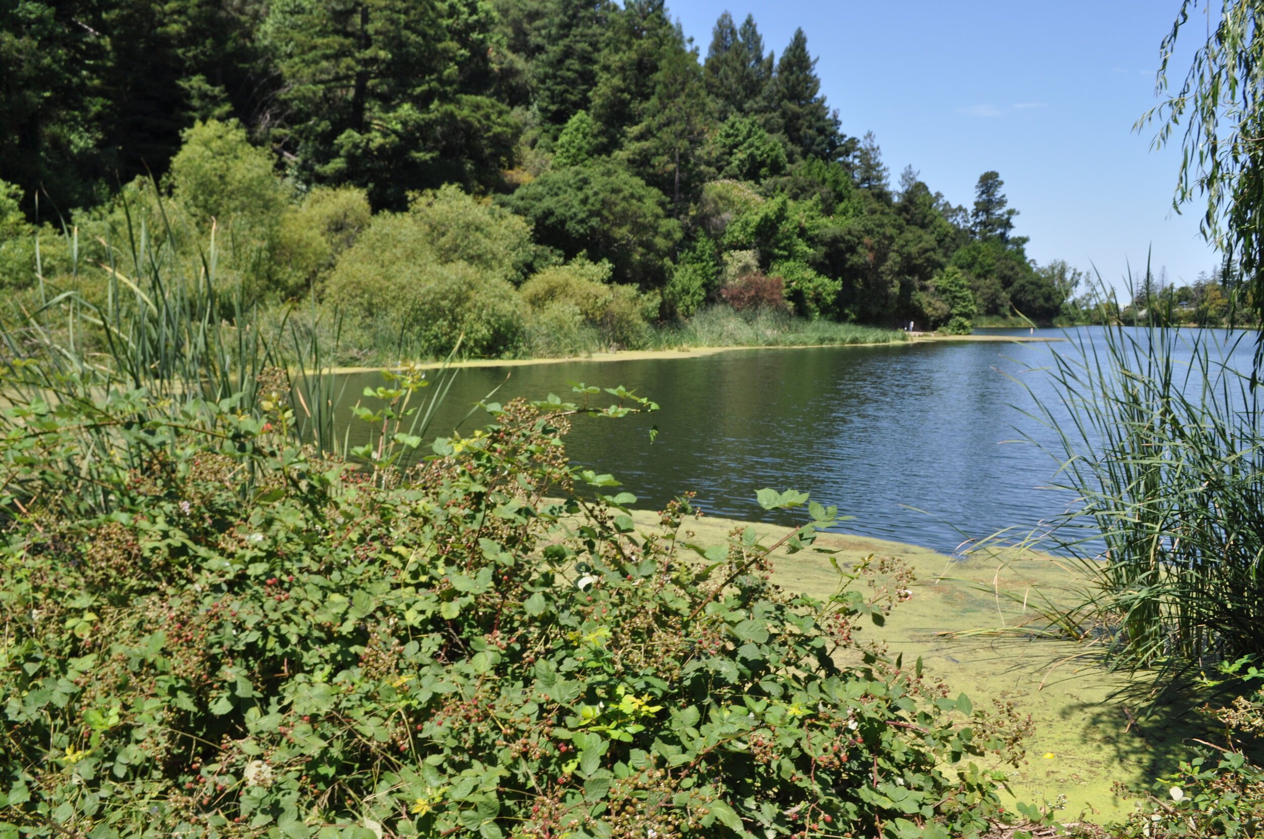
Lake Temescal: An earthquake-created Sag Pond, a depression in the ground formed where the Hayward Fault splits the earth directly below. The dam constructed here by Anthony Chabot established Oakland’s first drinking water reservoir, only serving that purpose 2 years before Oakland’s rapid expansion required more water. Swimming is prohibited and the parking lot is closed during shelter-in-place, but if you can park on the street and walk in, splendid paths around the lake remain open for now.
Oak Vale Avenue: A stroll along a beautiful (wealthier) Berkeley street reveals how neighbors used to accommodate the flows of the creek into the village planning. Multiple cute bridges and ponds.
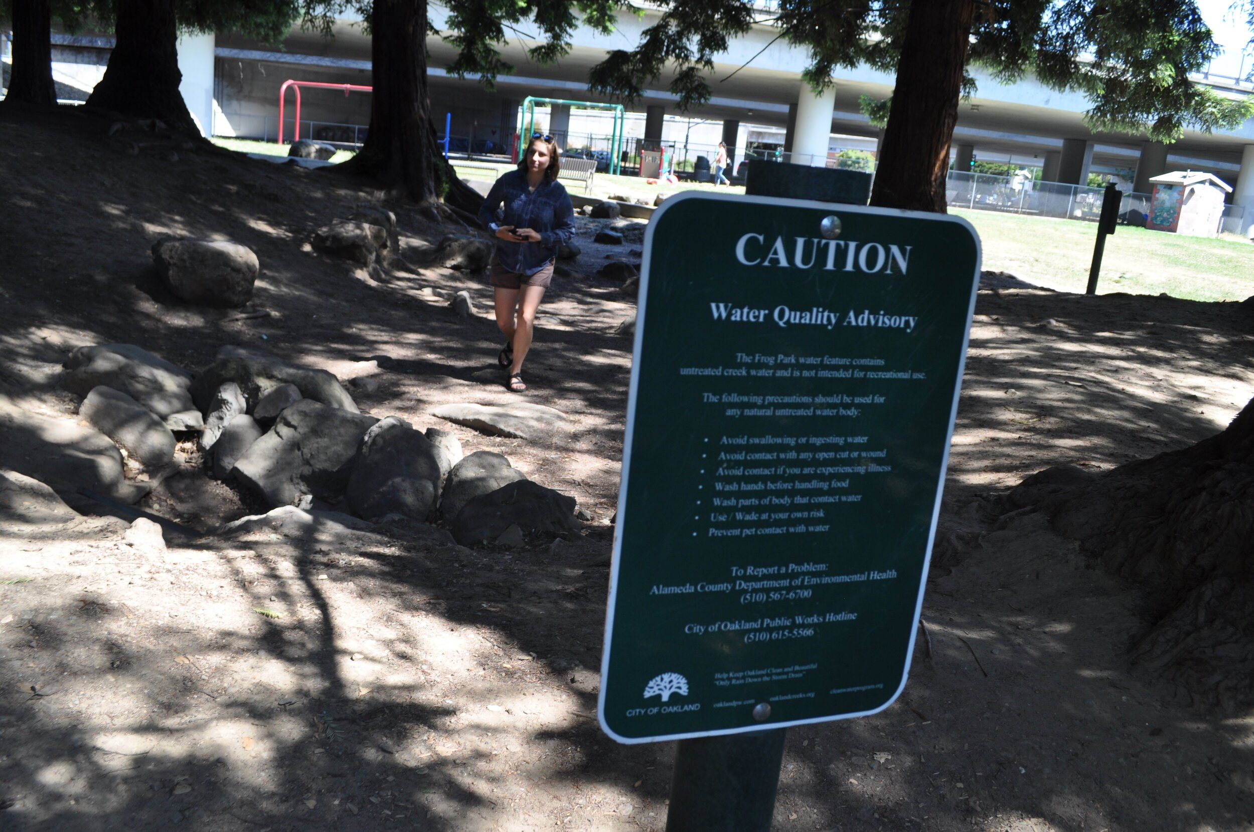
Frog Park: The beginning of a “false creek bed” which mirrors aboveground where the creek flows hidden below, the series of parks between here and the Oakland DMV are reminders of what once flourished before the neighbors' own pollution created the illusion of a creek nuisance, banishing the waters into culverts, increasing flooding, leading to more culverts, perpetuating a vicious cycle.
Temescal Creek Park: While Temescal Creek provides the name and curvy contours of this park, it remains 10 feet underground here, though you can hear and see the creek flowing through a grate on the northwest side of the park.
Shellmound Memorial: Originally 5 or 6 shellmounds, with sizes up to 60 ft high and 350 ft in diameter, occupied the mouth of Temescal Creek here, the largest shellmounds of 425 which surrounded the Bay. Shellfish, animal remains, and the bones of indigenous ancestors made up the mounds over multiple generations. The arrival of the Spanish and the mission system decimated the Ohlone Huchiun populations, though fortunately descendants are still active today, holding protests outside the mall (the most recent occupier of this sacred place after an amusement park, dance pavilion, race track, and heavy metal industrial sites) gathering every Black Friday, the day after a Thanksgiving sunrise ceremony on Alcatraz Island. The creek has a few hundred feet of daylight to admire here. But please remember the bones of the first peoples that were used to make these sidewalks.
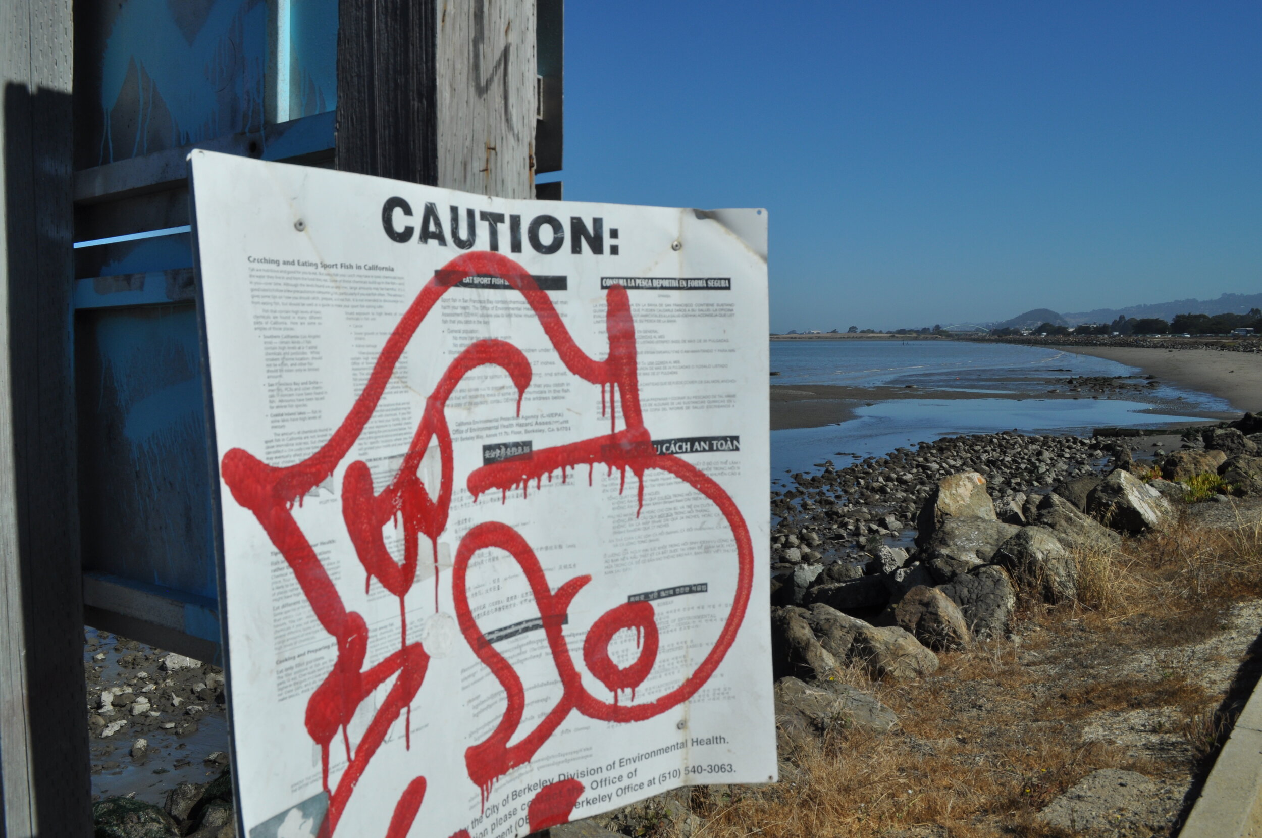
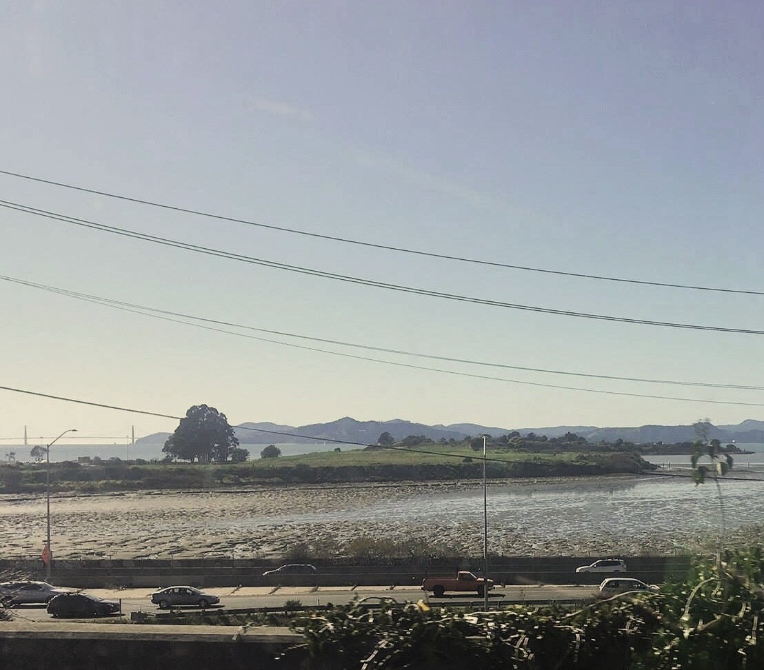
Eastshore State Park: The current outflow of Temescal Creek, pushed hundreds of feet west and north through development and fill-in of the Emeryville Crescent, still provides habitat for a diverse congregation of water birds and larger fish, angling for all the tasty critters that gather where fresh water meets salty. No longer a repository for heavy metals, nor a mudflat gallery for driftwood sculptures, a strange sense of peace still pervades this location. Park along Powell street, a walking path can curve you out towards the Bay Bridge for a closer look.


Codornices Creek ~ Berkeley/Albany
Codornices Creek, the most open and intact creek in Berkeley, once filtered through a large soft salty marsh, near a Huchiun Ohlone village tucked behind the little hill of El Cerrito. When the first adobe appeared at the creek banks near Westbrae, sons of the first Spanish settler named the creek codornices for quail eggs they found ~ an animal population not quite as decimated as the bears this creek’s Grizzly Peak hillside headwaters were named for. Pete and Hannah Berne, two freed slaves who became Berkeley’s first black residents, arrived and lived along the creek in 1858. The lower creek forms the boundary between the cities of Berkeley and Albany, a reason development has been less rampant on the creek edge.
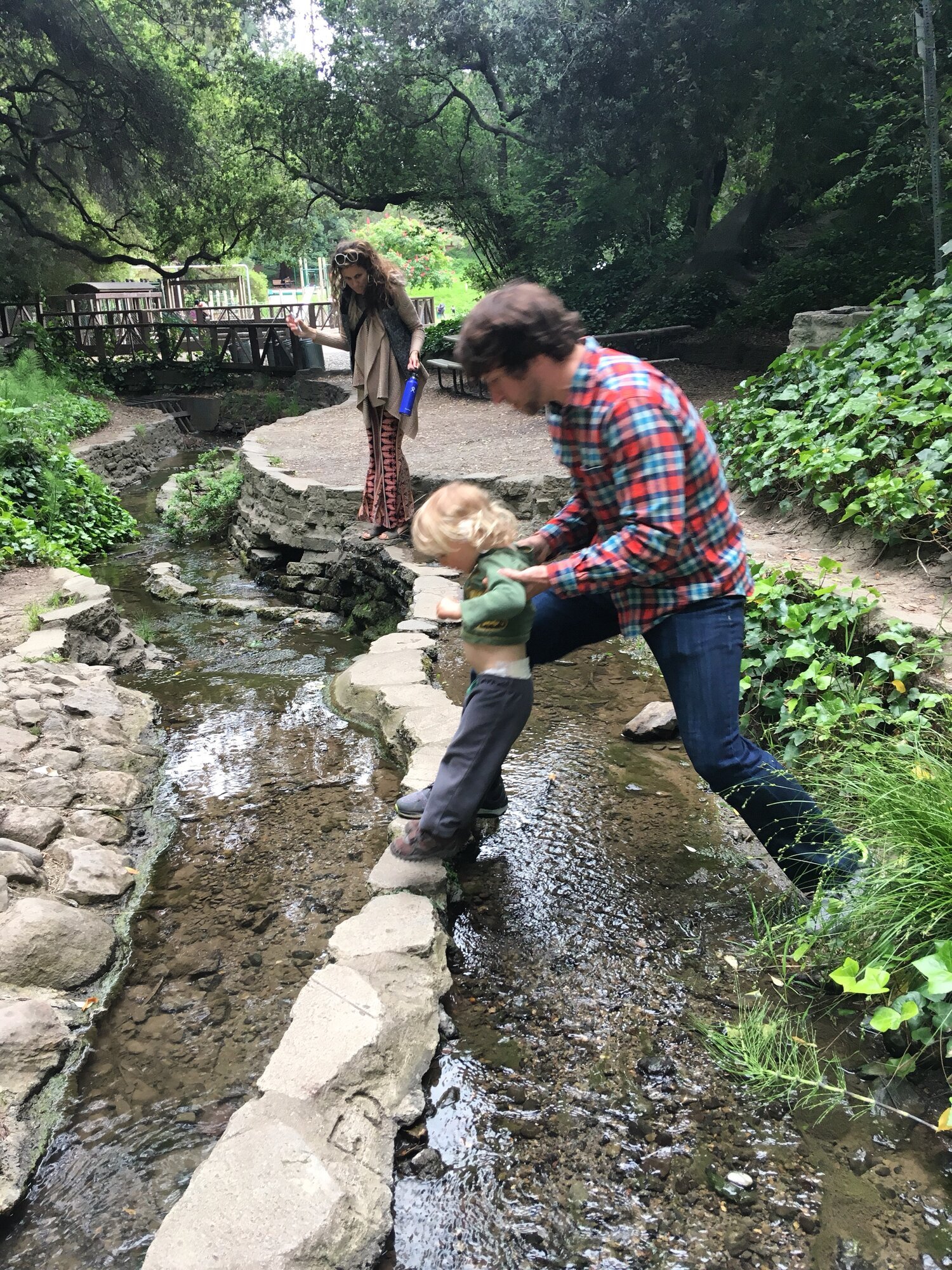
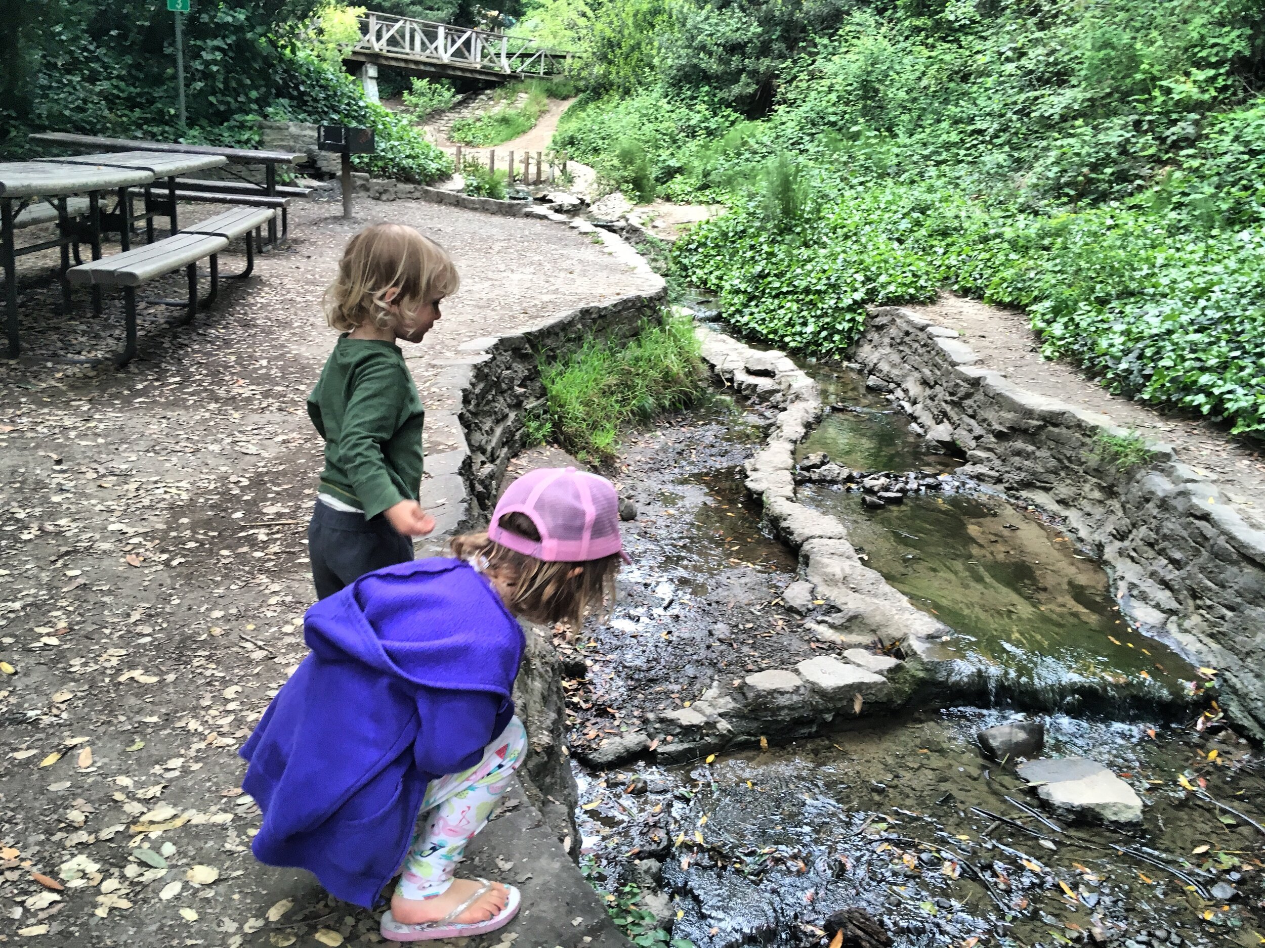
Gone to a not-so-distant past are a quarry, various swimming holes, wooden streetcars, a “noxious industry” zone which featured an incinerator, a dynamite factory, a dump, and a slaughterhouse ~ and what remain are a series of creek-considerate parks, including Codornices Park where several hillside creeks confluence and form a fully flowing force (faster and prone to flooding the more culverts our creeks are forced through), then gently sloping Live Oak Park and neighborhoods nestled in tall trees these creeks can support, a bridge by where the first adobe stood, then across the flatlands, evidence emerges of decades-worth of improvements and care where Friends of 5 Creeks have supported placed-based education and the return of Steelhead and Rainbow Trout since the 1990s, populations hoping to rebound again after a garbage truck fire in 2019 resulted in fire-retardant foam entering the creek, tragically killing hundreds of fish.
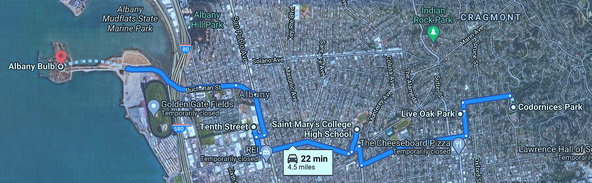
This tour visits 5 spots, which take about 22 minutes in all to drive. Including walking explorations, especially the first and last parks, the tour could be extended by several hours.
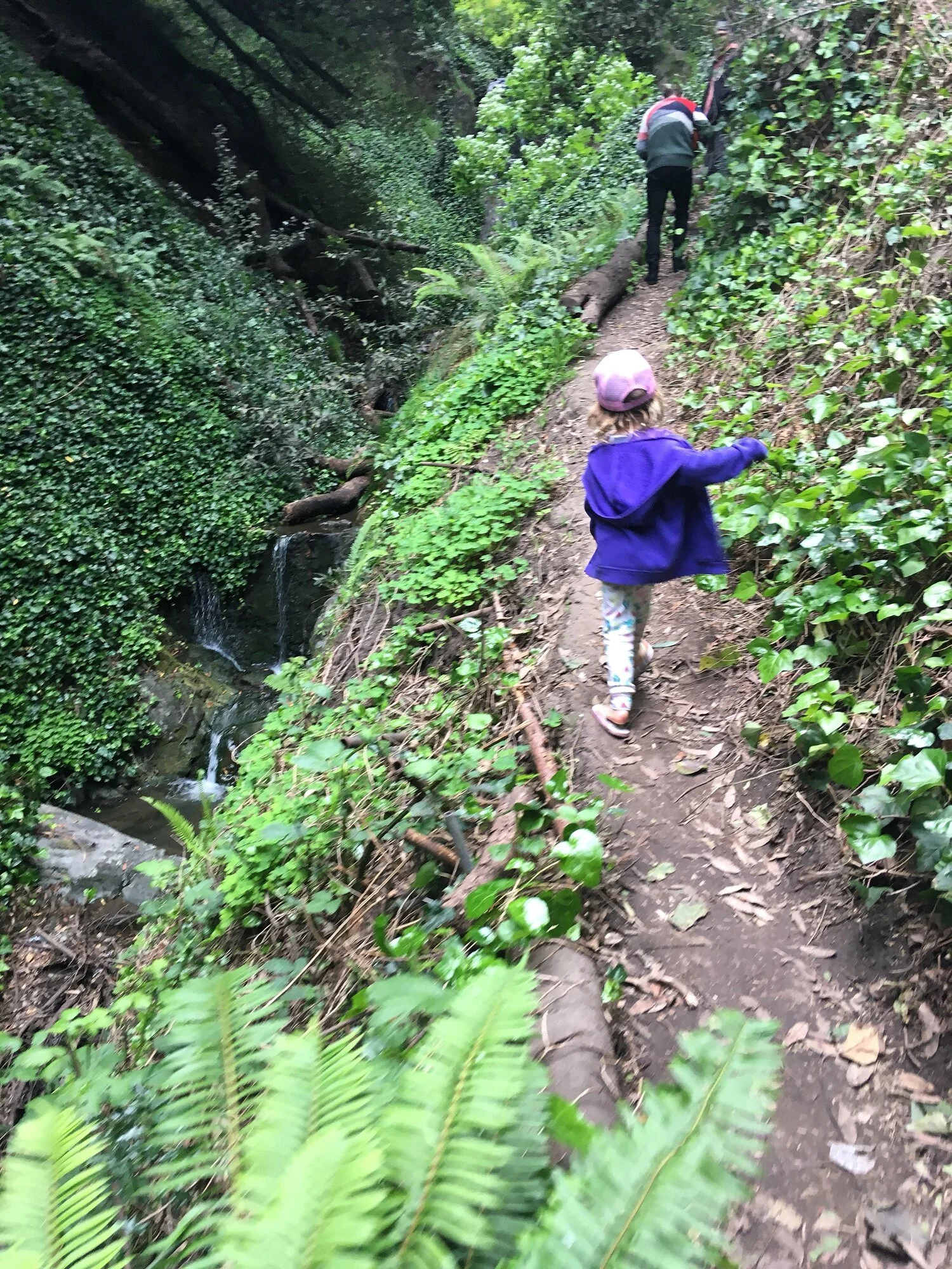
Codornices Park/Benner Falls ~ A gorgeous “secret” waterfall can be found on the north side of the park, via a path near Tamalpais steps that respectful (and safely distanced) public are allowed to use. This is the north fork of Codornices Creek. Near the big slide side of the park, the south creek fork glides by. Just down the street is Berryman Reservoir, one of the neighborhood’s first drinking water sources - tho proximity to the Hayward fault kept it closed for decades. Just across the street is the Berkeley Rose Garden, where the north and south creek forks meet underground and join together near the bottom of the garden.
Live Oak Park ~ Walking between parks is available along the creek via steep Berryman path. Where the creek meets Oxford there is a plaque commemorating the Napoleon Bonaparte Berne house, which unfortunately b(e)urned down in the 1980s. At Live Oak Park, Berkeley’s first nature park, the creek flows under tall redwoods and cradles stonework and fireplaces built for community gatherings before WW1.
Bridge at St. Mary’s College High School ~ end of Albina Street, a pretty bridge, a nice and noticeably middle ground in riparian ecologies, between hillside tall trees and the flatland flora, and the site of the first Spanish settlement in the area, part of the Domingo Peralta’s Rancherio San Antonio, near where they found the quail eggs. Both the Peralta and Castro adobes were still standing but in disrepair by the 20th century. The Castro adobe was refurbished and used as a casino until an arson in the 50s. The 2019 garbage truck fire that resulted in 20 gallons of flame-retardant foam entering the creek and killing hundreds of fish happened uphill from here on the 1600 block of Rose Street.
Path between 10th St and Train Tracks ~ Extensive restoration efforts have supported this stretch of flatland creek. The creek historically merged into the marsh at 3rd street, before landfill expanded developable “solid ground” out towards the open water. As Berkeley industrialized, the air here became caustic with pollutants, the waters black, red, and green from chemical factories, and the area became a popular site for roadhouses and brothels. Before woman’s suffrage Berkeley’s first NIMBY housewives organized to move the garbage dump from this neighborhood, leading to the official incorporation of Albany in 1908, with Codornices Creek as its boundary from Berkeley.
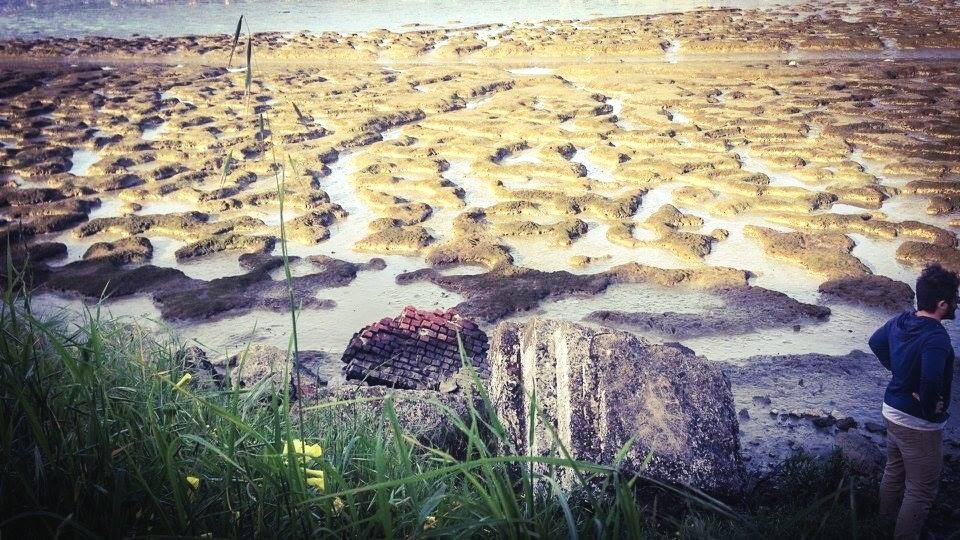
Albany Bulb Mudflats ~ Albany Bulb and the racetracks were an extension of small rises stretching bay-ward from “the little hill”, and featured a crescent of sandy beach. Albany Hill was used as a dynamite factory in the 1880s, and they planted eucalyptus here and all along the Berkeley/Richmond waterfront to muffle the sounds of explosions. One explosion was so huge it killed 35 workers and blew out windows in Oakland and SF. The elevations towards the Bay were flattened to form the race track, which stayed open only one year before falling into bankruptcy as the horses kept sinking into the marshy mud. During WWII it served as a naval aircraft testing ground. As it recovered from landfill status after the 1980s, Albany Bulb filled with magic found-object art and structures, and at its fullest a community of several dozen made their homes there. The Codornices Creek oozes into the mud flats from the northeast corner of the bulb.